Maps of Retreats (Click to Downlaod):

Shasta Lake Map section:


Shasta Lake Map section:


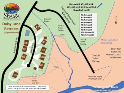


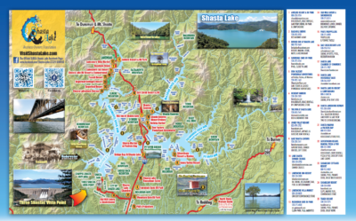
Shasta Lake Map section of this website provides essential navigation tools for visitors and outdoor enthusiasts exploring the vast and intricate landscape surrounding the lake. These maps detail the geography, topography, and points of interest, offering a comprehensive overview of the area’s recreational opportunities. Shasta Lake, with its numerous coves, inlets, and islands, requires detailed maps to help boaters navigate its expansive waters.
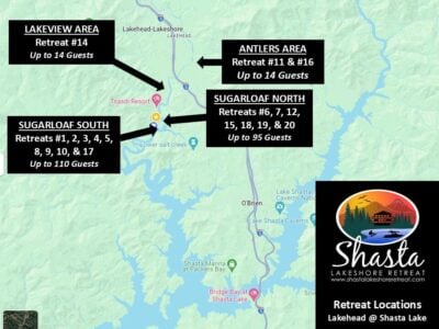
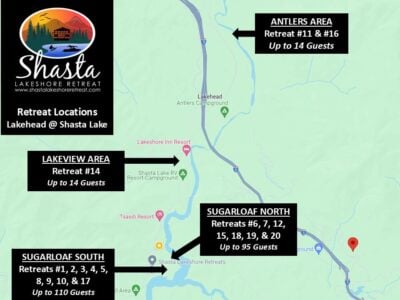
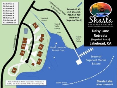
For those seeking vacation rentals, lakefront properties are often prominently featured on these maps like the Shasta Lakeshore Retreat, allowing travelers to identify ideal locations for their stay. The maps also highlight key amenities, such as marinas, campgrounds, and hiking trails, providing valuable information for a well-rounded experience.
Whether in digital or physical form, Shasta Lake maps serve as indispensable guides for planning adventures, fishing expeditions, or simply enjoying the scenic beauty of the region. They aid in understanding the lake’s hydrology, showcasing depths, and indicating areas where various fish species are abundant.
As technology advances, interactive online maps with real-time data enhance the visitor experience, offering live updates on weather conditions, water levels, and recreational events. In essence, maps of Shasta Lake serve as an essential companion, ensuring that explorers can make the most of their time in this picturesque and diverse destination.
.